Yosemite iOS apps (yes, really)

Last month I had a lovely time in Yosemite with my family. I grew up in Southern California so I've been to Yosemite a dozen times before, but I really love going in the Winter because barely anyone is around. You can hike to many places in peace, you can get dinner at every restaurant, and you can enjoy views without having to rush along.
On a lark, the week before we went I searched the App Store for "Yosemite" just to see what came up. I downloaded half a dozen things and most weren't much help during my trip but there were two apps worth mentioning because I found myself using them many times during our week there.
California State Parks ($0.99) Every time you're in a California State Park, there are maps. Maps they give you when you go in, maps of shuttles, maps of parking lots, etc. This app had a free downloadable pack of Yosemite maps and I used this daily while in the park. I not only got to see myself as a nice blue dot on any of the maps, when we were pressed for time, I could locate the nearest shuttle bus stop, I could tell where to park near hiking trails, and I could tell which route was shortest to a waterfall. Totally worth the buck and way easier to carry than a stack of maps.
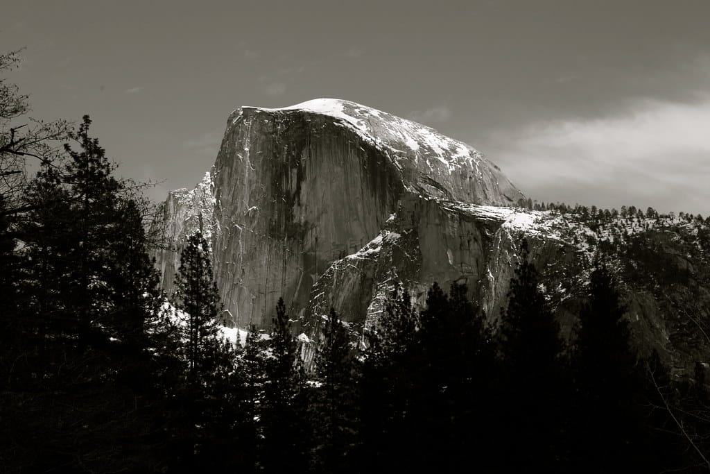
The Photographer's Guide to Yosemite ($6.99) There are lots of photo classes in Yosemite Valley and there are professional courses you can take to learn where to stand and when to take the best shots possible. These classes start at about $100 and go up into the thousands for a several-day outing with the pros. One pro photographer took everything he knew about shooting photos at Yosemite and put them all into this amazing app. You can tell the app when you're in the park and what time of day it is, and it will tell you the exact places and shots you can get if you follow their tips. It's really incredible because some of the tips involve windows of only a few days a year where something is lit up just right. I didn't plan my vacation around this app, but when I had some time in the afternoon, I knew where the best place was to park and get out and take a shot of Half Dome seen above (on a bridge a couple hours before sunset).
That said, Verizon phone coverage was generally pretty spotty in the valley, and even my high end accomodations at the Ahwahnee came with spotty WiFi so getting online or uploading photos was dodgy at best all week. Both of the apps above worked fine offline (once you download the right map pack over WiFi).