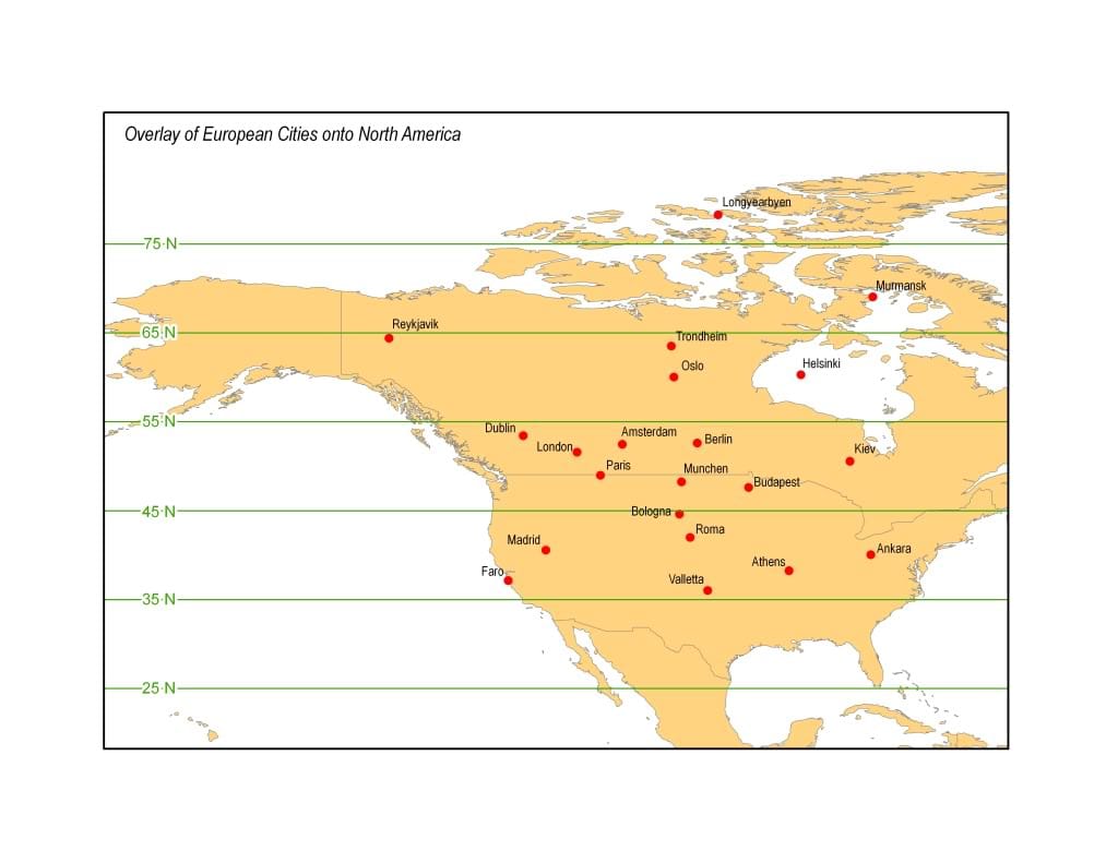
North America - Western Europe equivalent latitude maps

When I first moved to Oregon I often heard local Pinot Noir wineries proclaim "we're at the same latitude as the best wine regions in France! That's why our wine is great here too!" Every weekend in the Fall, I get muddy in local bike races then go home to watch similar races taking place around Belgium, with similar weather and I've often wondered how my latitude compared with theirs.
Now I know that latitude determines length of daylight pretty consistently but isn't a great comparison to weather -- The west coast of the US has a cold ocean current and a jet stream to match while the Atlantic that makes up the west coasts of the European continent has a warmer ocean current and different weather to match. Still, it's interesting when making rough comparisions to know if Los Angeles is really like the south of France/Italy (it's actually in Northern Africa, latitude-wise), and I've wondered ever since a friend moved to Helsinki if that was as far north as our Alaskan cities (it is).
Today I asked on Ask MetaFilter and a GIS expert member whipped up exactly the maps I envisioned.
Here are major European cities overlaid on North America, corrected for the identical latitude:
Here are North American cities, overlaid on Western Europe and Northern Africa at the identical latitude:
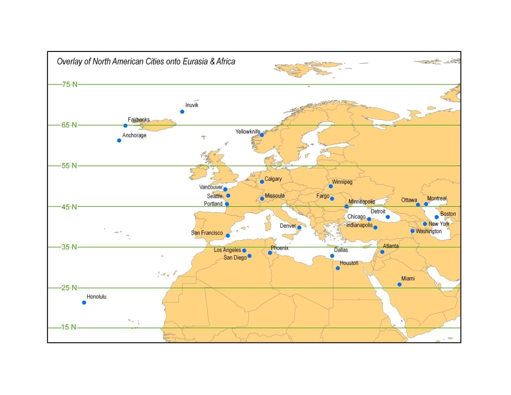
Pretty cool stuff. I never knew Paris, France was at a latitude farther north than Fargo, North Dakota, or that so much of Western Europe was farther north than the US-Canadian border.

If you found this post useful, you might want to check out Maphead from Ken Jennings that goes way deeper into how maps shape our view of the world.
