Some tips for road trips

Since the pandemic began, I've been taking lots of solo road trips around the western US in lieu of flying. And after 20,000 miles of trips in the last couple years, I thought I'd write up some tips I picked up along the way.
Reduce your speed, reduce your anxiety
I'm pretty serious about driving but 15 years ago I was one of those idiots that drove 90mph everywhere with a radar detector in my car always scanning for cops. But doing long, multi-state trips taught me that the benefits of getting somewhere 20-30 minutes faster isn't worth the high anxiety and worry that's always in the back of your mind when you're speeding, eyes darting to spot cops on the horizon.
These days, I drive no more than 5-10mph over the speed limit on freeways, and I also try to stay out of the fast lane as much as possible, only using it for passing trucks. I can relax when I set my cruise control to 72 in a 65mph zone for hours on end. It doesn't take much longer to get you anywhere and you can free your mind and your energy for other things like enjoying the view or your music.
The Hilton app is surprisingly amazing
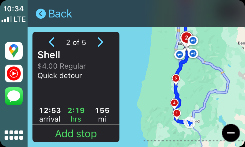
My typical road trip schedule each day goes like this: Wake up whenever, get some breakfast, travel around and see things and take photos and do stuff in one town, get some lunch, then at some point in the afternoon I get on the road and drive for about eight hours to get to another place far away. Driving mostly at night means I don't really miss any sights since I tend to enjoy them earlier in the day instead.
I usually start these journeys by pulling over and picking a town on Google Maps that I will get to between 11pm and midnight. Then I open the Hilton app and see if there are any properties near that town. If I find a decently cheap one, I reserve it.
I don't particularly love Hilton but it seems like only three or four companies own almost all hotels you see along interstates and Hilton owns the pinnacle of predictable mediocrity, a Hampton Inn. I'm always looking for Hampton Inns and Hilton Garden Inns near major freeways.
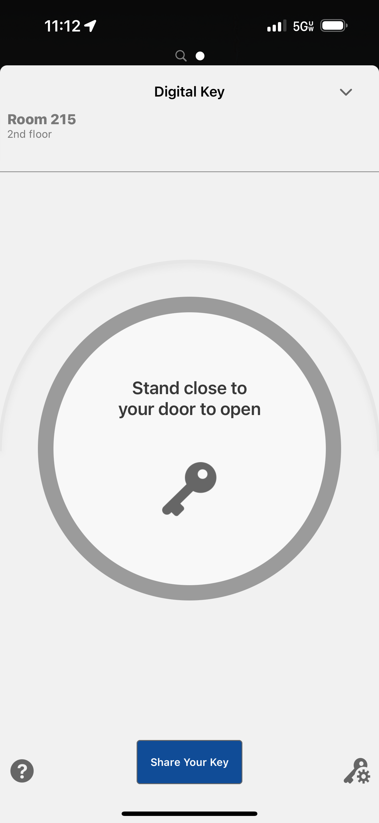
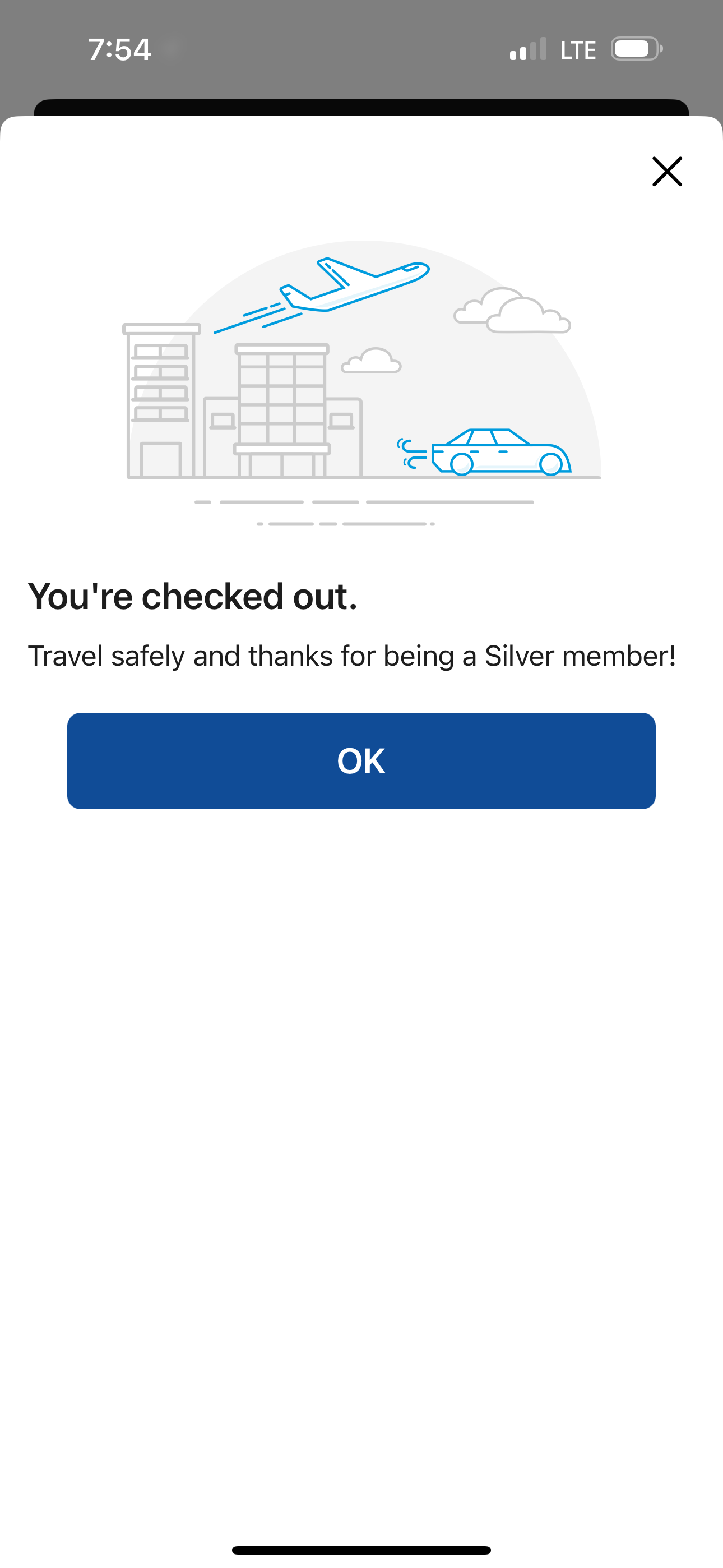
But here's where it gets great: several years ago Hilton developed a NFC system for giving you "virtual" hotel keys on your phone. Now, the virtual keys only get added to your phone about half the time, but when it works, it's amazing.
Here are some screenshots of the Hilton app in use:
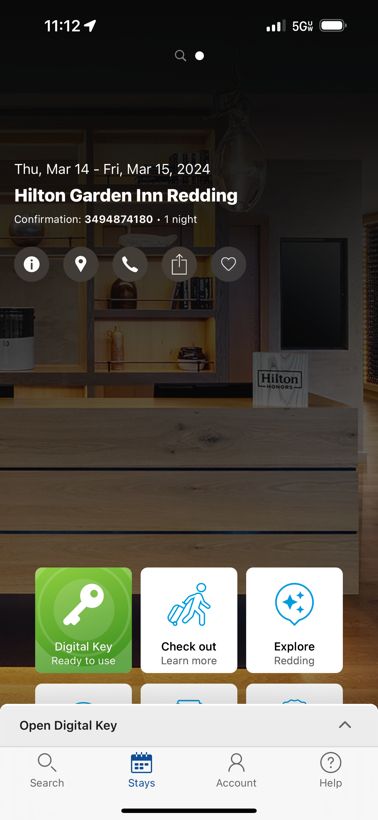
- You can reserve a room from your phone in about 30 seconds if you store your credit card in your Hilton account.
- During the process they'll let you check in, give you a room number and ask when you plan to arrive.
- If you pull-to-refresh your reservation (there's no UI affordance to "update what I'm looking at to get the latest"), eventually they may give you a digital key.
- When you get to the hotel, you park, walk in, and go directly to your room. Your digital key lets you inside by tapping it outside the door. If the front door is locked after hours, your digital key also lets you through the front doors of the hotel.
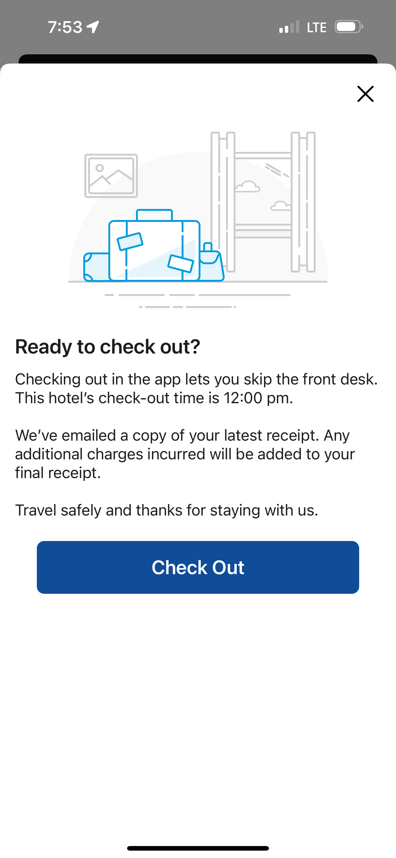
- When you pack up to leave in the morning, you just tap "check out" and walk to your car and leave.
Like I said, when it works, it's amazing and efficient and wonderful compared to driving around at 11pm asking various hotel front desks (after you usually wake the front desk worker up) to book you a room which always seems to take 15 minutes to get inside your actual room.
When I've spent a day driving eight hours and I pull into a strange town, I just want to get into my room, brush my teeth, and go to sleep. Using Hilton's app makes that as easy as possible. It is weird the app also eliminates all human interaction and reducing labor costs is probably why Hilton did it, but not a second of your time is wasted, and that time is better spent on your trip.
How are Google and Waze owned by the same company?
This one is more of a rant, but I tend to use both Google Maps and Waze when I'm on a long road trip for a variety of reasons. Here are each of their strengths and weaknesses.
The pros of Waze
- It warns you about stalled cars on the roadside, police, and debris in the road along your journey—things Google Maps doesn't warn you about
- It tends to route you in the most direct way possible, saving substantial time over Google Maps estimates
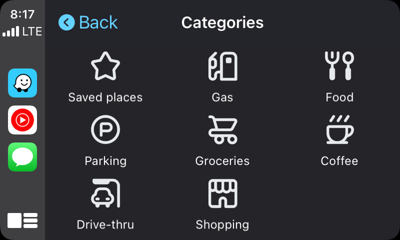
- It has a "drive thru" option in the categories section, which is perfect for road trips. Google Maps only has "restaurants" which isn't what I want when I'm on the road and don't have an hour to sit down and eat.
- It always shows you speed limits and your current GPS speed (plus it's in red if you're over the limit).
The cons of Waze
- No rest stops as a category when driving somewhere? That's bonkers. Naps when drowsy are key to safe traveling
- If you say you want the nearest gas station, Waze shows you a list of addresses of gas stations. That's close to useless (especially in unfamiliar places) since some may be miles behind you already.
The pros of Google Maps
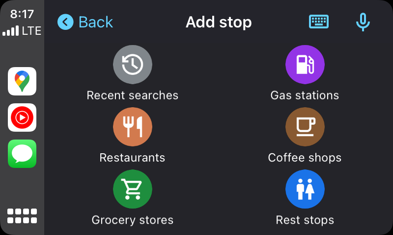
- Yay, it has a shortcut category for Rest Stops! And it directs you to stops ahead of you, rarely telling you to go to one you just passed.
- When you tap on Gas stations, you get a map showing your current path and where each is located along the way, which is a super helpful way to find one!
- Whenever you add a stop to an existing trip, Google Maps always finds things in the direction you're traveling in, Waze seems to just do a circular search around you and might mention something you've already passed.
- I find re-routing around an upcoming emergency/accident in Google Maps to be really dependable. If Google Maps ever tells you to get off at a random exit on your longer route DO IT IMMEDIATELY and you'll avoid lots of huge slowdowns/accident backups.
The cons of Google Maps
- You only get a current speed limit display if you're navigating somewhere, it won't appear unless you enter a route first. Waze shows it at all times.
- Google Maps tried to add Apple Watch support, where you get a buzz on your wrist when you need to turn. It rarely works for me (Apple Maps always buzzes my wrist for every turn even when I'm driving).
- On your phone, you can get voice cues set to Always, Never, and Urgent Alerts Only. I always leave it set on the last one. In CarPlay inside your car, you can only toggle the voice cues to always on or always off. You have to set it on your phone if you prefer the emergency only alert option.
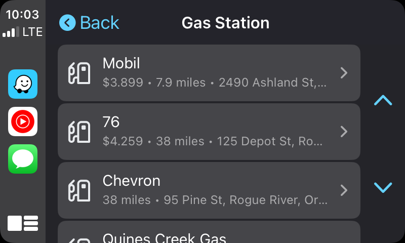
Gas station search in Waze (left) and Google Maps (right). One is clearly a million times better than the other.
Always read the plaque. Always stop at the photo point.
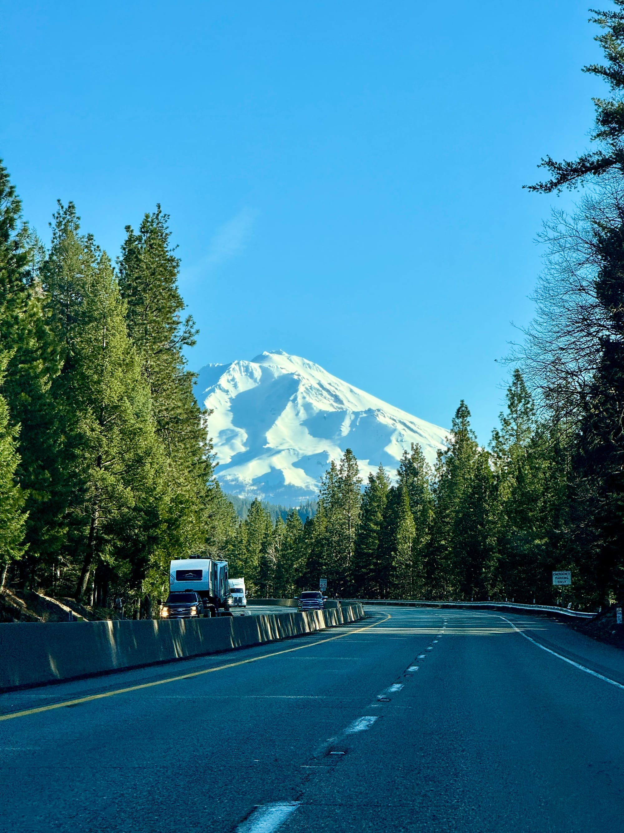
As the great Roman Mars once said: Always Read The Plaque. If you see a historical site ahead sign you didn't expect, stop and read the plaques. I am a huge fan of signs that tell you the geologic story of how something came to be and a total sucker for anything that mentions plate tectonics or includes a topo map.
If you spot a "photo point" sign or see the parking lot famous for a certain shot of a certain thing, always stop for it and take that photo of those incredible tall waterfalls or the big dinosaur from Pee Wee's Big Adventure or that beautiful sunset.
When I rode my bike down the entire Oregon Coast ten years ago, I realized quickly that if I felt the urge to take a photo but didn't, I would never be back at that same spot ever again to experience the very same thing I was looking at. So I started listening to my inner voice and any time it went "oh! cool! You should get a photo of that!" I actually stop, pull over, and take the shot. It leads to a life with much less regret.